
Backpacking
Virginia Pictures
Virginia Pictures
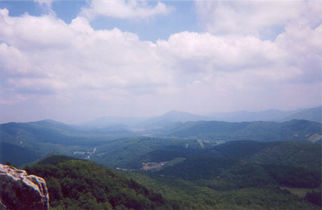
This is the view from Dragon's Tooth. You can't really see where we started or what we climbed to get here, but you do have the feeling of being the highest thing around.
![]()
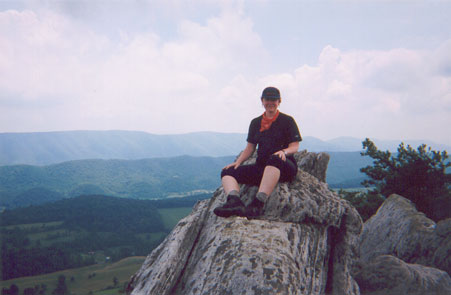
Here I am perched on a piece of Dragon's Tooth. This required actually climbing up rocks to get here, but it was sunny and breezy, and as mentioned above, you're the highest thing around.
![]()
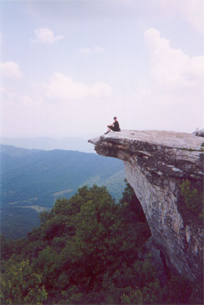
Here I am on McAfee Knob, the most photographed location on the A.T.
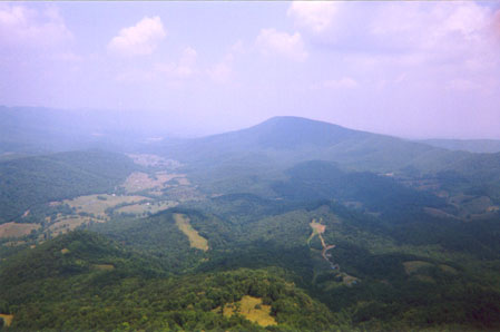
Here's the view straight out from McAfee. The mountain in the distance is Tinker mountain, and the ridge extending away from it and to the right is the AT's path to Tinker Cliffs, which we were about to follow when this photo was taken
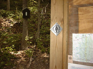
The blaze that launched thousands of steps -- this one is on the north side of Virginia Rt. 7, marked on your PATC maps as 'Snickers Gap'
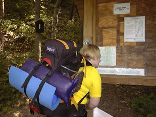
Here I am looking at the map. I have my own map, so I'm not sure why I'm looking at that one. More importantly, you'll note my pack. It's got as much in it here as it did on this trip. You can see my thermarest trying to slip out the right side of the sit pad -- that was a problem until I swapped those things out for the ridge rest.
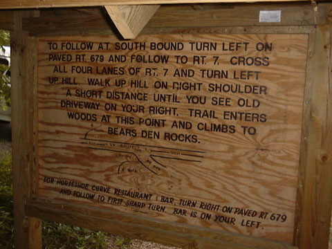
The sign I'm looking at above? Here's the back of it. Note that it contains directions on how to find a bar. I should have known this was pretty hardcore when they tell you how to find a bar at a trail access point.
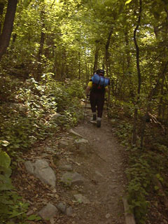
Here I am walking up out of Snicker's Gap. Thus ends the pictures from Virginia. I have one picture from Crescent Rock, but it really sucks. Pictures of views just don't reflect the whole atmosphere up there -- not even the panorama shots.
Backpacking | Gear | Trip Reports